A series of powerful floods has left a trail of destruction across the northwestern United States in recent days, closing roads and damaging key infrastructure in communities near iconic national park and national forest sites, such as North Cascades National Park and Mount Rainier.
In early December, an atmospheric river made landfall over the Pacific Northwest, when early-season snowpack was already fragile. Record-breaking rains have caused catastrophic washouts, mudslides, and emergency declarations across Washington and northwestern Montana.
As much of the western U.S. is still scrambling around washed-out roads and thousands are left without power, Outside is taking a look at what that means for access to National Parks, ski resorts, and other popular outdoor recreation destinations.
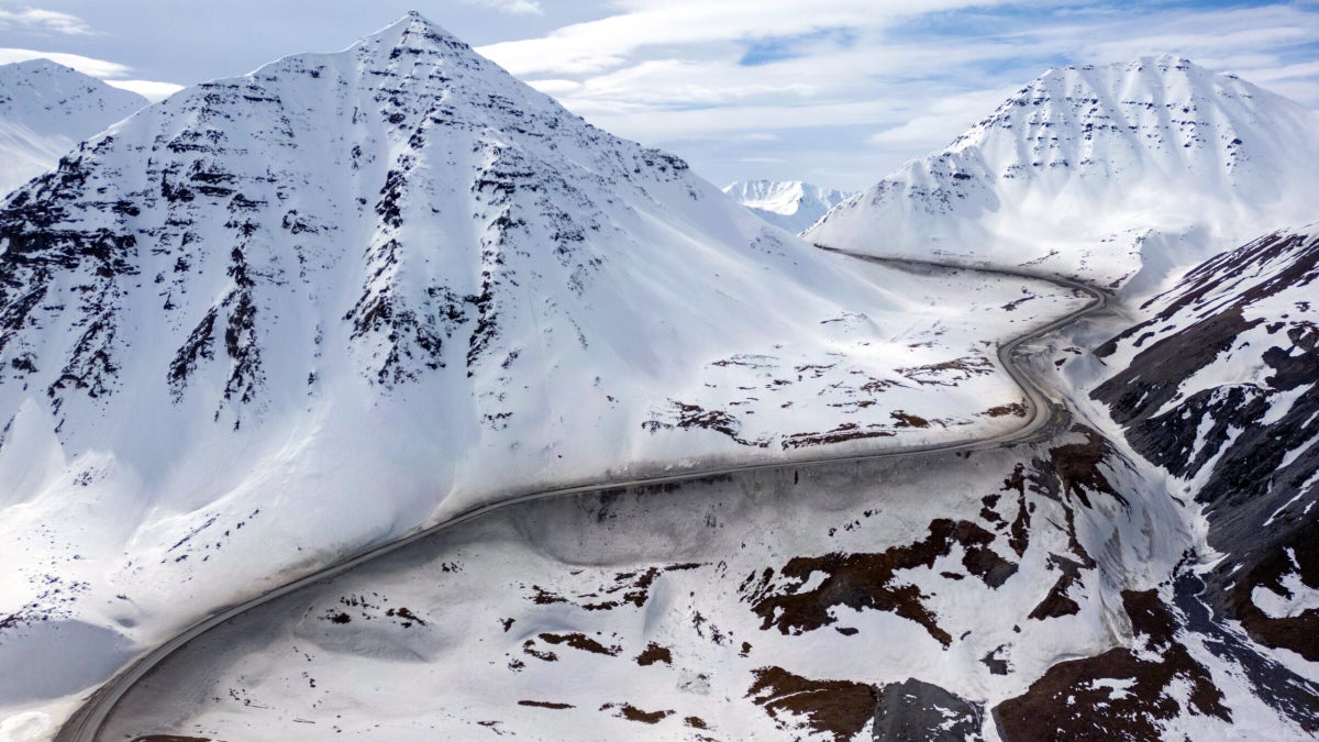
Stevens Pass, An Iconic Ski Area, is Closed for the Foreseeable Future
In Washington, the Cascades are facing some of the most severe infrastructure failures in recent memory. Several east-west highways that provide transit across the Cascade Range are closed, and there’s no sign of when they might reopen.
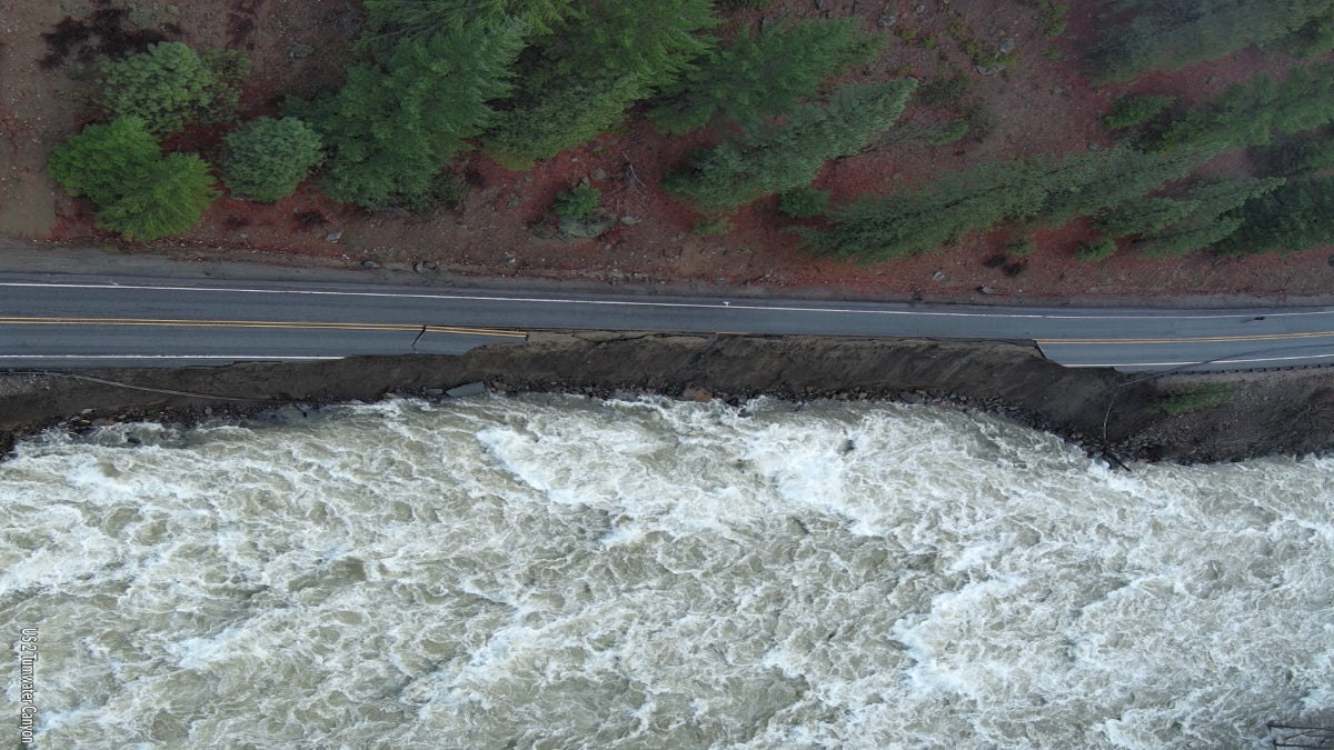
According to the Washington State Department of Transportation’s live travel map, U.S. Route 2, the access point for the skiing hub of Stevens Pass ski area, is closed for nearly 50 miles, with sections of the road completely underwater and “rocks, trees, and mud over the roadway in multiple locations.” At least one section has also collapsed into a nearby river.
The closure, which stretches from the town of Skykomish to Leavenworth, through the sprawling national forests of Mt. Baker-Snoqualmie and Okanogan-Wenatchee, has cut off a primary route for winter recreation. And because the storms are still ongoing, the damage may get worse. Officials say it’s possible Route 2 will not open for months, and no detour is available.
“We are going to do everything we possibly can to repair it as quickly as possible, but it’s literally underwater at some stages,” said the state’s governor, Bob Ferguson, to The Seattle Times. “There are major, major issues on that roadway.”
At least one individual has died in the flooding after trying to drive through it, and there have been more than 1,200 evacuations and rescues in the state to date.
“We’re in it for the long haul, and all that water is putting a lot of stress on our infrastructure,” Ferguson told the Times. “If you get an evacuation order, for God’s sake, follow it.”
No Services Available in North Cascades National Park
The storms have also hit Lake Chelan National Recreation Area and North Cascades National Park. Stehekin, the park’s southeastern gateway community, has lost its water treatment plant.
Multiple sections of State Road (SR) 20—known as the North Cascades Scenic Highway—are closed in both directions. At least two other roads in the area, the Stehekin Valley Road and Cascades River Road, are also currently closed.
In a press release on December 14, park staff noted that an evacuation order had been issued for the Stehekin Valley and said, “Visitors should not travel to the Stehekin area; there are no services available.”
The North Cascades National Park website lists road closures in the area.
Closures Abound in Mount Rainier National Park
Some of the key wilderness areas around Mount Rainier National Park are also experiencing damage from the storms. U.S. Route 12, which heads into the park from the east, is closed due to high winds and numerous fallen trees. Meanwhile, SR 410, the access road for a popular nearby ski resort, Crystal Mountain, is also closed.
Another one of the park’s main arteries, SR 165, is closed due to bridge damage, cutting off access to spots like Mowich Lake and the Carbon River, home to the lowest-elevation glacier in the contiguous U.S.
Olympic National Park Remains Susceptible to More Storm Damage
The Olympic Peninsula has also been inundated. In Olympic National Park, the Hoh Rain Forest, one of the largest temperate rainforests in the U.S., is closed due to flooding. Multiple campgrounds and roads in the park have been closed in anticipation of high winds and heavy precipitation.
Officials with Olympic National Forest published a news statement on December 15 stating that it’s too early to assess the extent of the damage. Still, they noted that the region’s fragile soil and steep mountains make it particularly susceptible to washouts.
Olympic is still recovering from the Bear Gulch Fire this summer, which burned over 20,000 acres, and the aftermath of these fires may make the park hard hit by the storms.
“Burned areas have an increased likelihood of landslides, mudslides, flash floods, and debris flows due to the lack of vegetation and unstable soil,” the park’s release explained.
Montanans Cut Off near Glacier National Park and Kootenai National Forest
Northwest Montana is grappling with its own storm-related woes, including tens of millions of dollars in damage, according to Montana Free Press.
In the town of Libby, a primary gateway to the Kootenai National Forest and the Cabinet Mountains, at least six bridges have been destroyed or compromised by surging whitewater. The city remains under a boil water order as officials conduct controlled releases to prevent the complete failure of a nearby dam. The Forest Service is publishing a list of currently inaccessible sites in Kootenai, which includes at least 11 roads as of this publication.
The Blackfeet Nation, located on the eastern border of Glacier National Park, also declared a state of emergency on December 13. Flooding there has decimated critical culverts and tribal roads, displacing families and complicating access to the park’s eastern entrances.
Although Glacier’s Going-to-the-Sun Road is already under its standard winter closure, the broader regional damage means that even the year-round access points to the park and its surrounding wilderness are now fraught with hazard.
Communities Brace for More Storms Ahead
As more storms move through the region, the timeline for reopening some areas remains uncertain. Authorities are urging all travelers to heed evacuation orders, respect road closures, and check local government updates before heading out, noting that even familiar routes may now be impassable or dangerous.
The post Historic Floods Sever Access to Some National Parks. Here’s What We Know. appeared first on Outside Online.