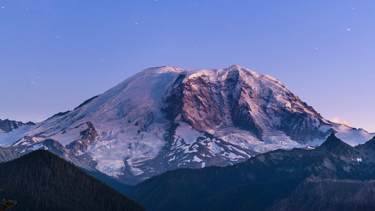
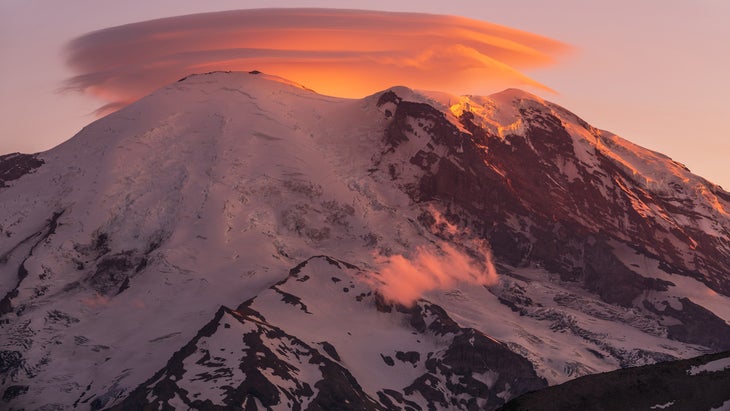
The highest point on Mount Rainier is no longer a perennially frozen ridge of ice and snow, but rather a mound of rocks located several hundred feet away. And this shift means the iconic peak is several feet shorter than previously believed, and is no longer one of the United States’ so-called “ice-capped summits.”
That’s the conclusion of a new study that was published on November 10 in the scientific journal Arctic, Antarctic, and Alpine Research.
The report suggests that, due to the warming planet, the contiguous United States has lost three of its five perennially ice-capped summits.
The category encompasses peaks that have a highest point consisting of snow and ice, not rock, year-round. Since alpine research was first conducted on such peaks in the 1950s, five of these mountains have existed in the contiguous U.S., all in Washington State: Mount Rainier, 14062-foot Liberty Cap, 9,432-foot Colfax Peak, 8,865-foot Eldorado Peak, and 8,322-foot East Fury.
“All five of these historically ice-capped summits have shrunk since 1980,” the study explains, “with four of the five shrinking by at least six meters (20ft) due to loss of snow and ice.”
The researchers attribute the loss of ice and snow to climate change, noting that “summit temperatures have risen nearly 5.5 degrees Fahrenheit since the 1950s, when summit elevations were first measured” and adding that roughly 90 percent of this warming and subsequent melting has occurred since the late nineties.
Researchers studied the peaks in 2024, and found that just two of the five summits—Liberty Cap and Colfax Peak—retained perennial ice as their highest point. The loss of the three former ice-capped summits is believed to have occurred for East Fury in 1990, Rainier in 2014, and Eldorado in 2020, the study said.
The researchers also note that because of melting, all of the peaks surveyed, including Rainier—long held to be 14,410 feet high—now actually have slightly lower elevations.
“The summits of Mount Rainier, Eldorado Peak, and East Fury have all shrunk by 20-30 feet from mid-twentieth-century heights and now have rocks as their highest points.”
Eric Gilbertson, one of the study’s co-authors, explained the change on Rainier on Instagram.
“The former ice summit Columbia Crest melted down over 20 feet,” Gilbertson said. “The historic elevation of 14,410 feet is no longer accurate.”
According to Gilbertson, Rainier’s new elevation is 14,399.6. “The true summit is now scientifically recognized as rock on the Southwest Rim, 430 feet to the south,” Gilbertson said.
Gilberston, a surveyor who is also attempting to become the first person to ascend the highest peak in every country on Earth, recently published data that suggested the Colorado peak Crestone Peak was actually shorter than its nearby sub-peak, East Crestone.
The post Did the Highest Point on Mount Rainier Melt? A New Study Suggests So. appeared first on Outside Online.