
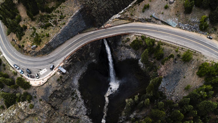
All dangerous roads are not alike. For some, like Florida’s US-1, which runs the length of the state’s east coast, it’s a matter of volume and geography, as in thousands of mixed-ability drivers negotiating stops, starts, and boredom. For others, like in Colorado, it’s high-altitude mountain passes that slither above ridgelines. Some are remote, as in the Dalton Highway. The sparse 414-mile Alaskan thoroughfare crosses the Arctic Circle at milepost 115 and contains few services. Of course, even the most benign-looking road can be challenging.
“A road becomes dangerous when speed, design, and driver behavior collide,” Jake Nelson, Director of Traffic Safety Advocacy and Research at American Automobile Association (AAA), tells Outside. Nelson analyzes crash data to help shape AAA safe driving policies and has developed many insights for driving on dangerous and not-so dangerous roads; advice that begins before we even leave our driveways.
“People forget that driving is a full-time job,” he says. “High speeds, limited visibility, tight curves, and distracted or impaired driving are a recipe for tragedy.” Nelson shares what to keep in mind before setting out on some of the most perilous roads in the country.
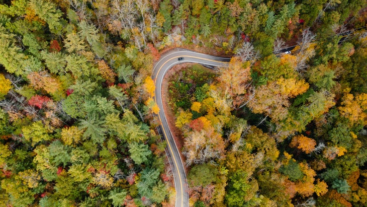
From Colorado’s Million Dollar Highway to North Carolina’s Tail of the Dragon, these roads with dramatic switchbacks and hairpin turns are indeed for the more adventurous—and careful—drivers.
Million Dollar Highway, Colorado
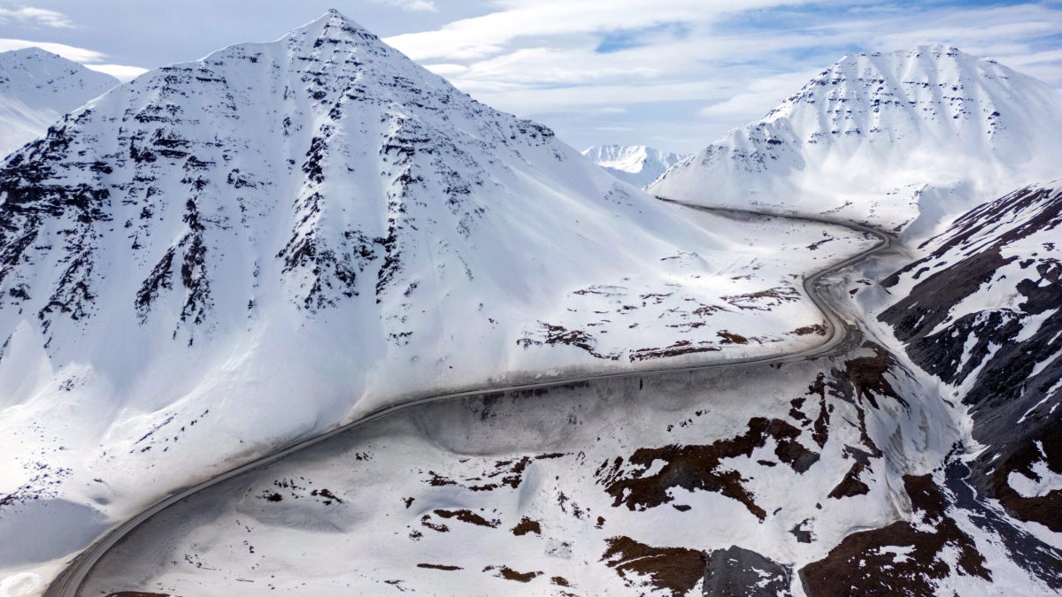
Colorado is awash with challenging roads that slip through canyons, climb to dizzying heights, and, in the case of U.S. Highway 550, follow a former wagon trail hurriedly built to move gold and silver out of the San Juan Mountains. Toss in erratic Rocky Mountain weather, such as sudden whiteout conditions at 11,000 feet over Red Mountain Pass, and it’s easy to see why this 25-mile connector between Silverton and Ouray always strikes a vein among most dangerous road lists.
“AAA always says: if you don’t need to go into inclement conditions, don’t,” says Nelson. “If you must drive, go slow, avoid sudden movements, and give yourself plenty of space. Pavement traction disappears much faster [when it’s snowing] than people think.”
Tail of the Dragon at Deals Gap, North Carolina
There aren’t many perilous roads that host their own website. Enter Tail of the Dragon, aka U.S. Highway 129, a stretch of pavement in the Great Smoky Mountains that entices drivers with 318 curves in 11 miles. This challenging route through Cherokee National Forest has long been considered a must-visit course for sports car and motorcycle enthusiasts, especially.
Jake Nelson contends that even a road containing more than three hundred curves over just a few miles doesn’t have to be dangerous if the driver is alert and prepared. “There’s no single ‘most dangerous’ road,” he says. “The road that becomes dangerous is the one you’re on when someone is speeding, impaired, or distracted. Behavior—not geography—is the biggest risk factor.”
Dalton Highway, Alaska

Unlike I-95, I-5, and I-80, among other dangerous high-volume thoroughfares, most people will never drive the Dalton Highway. But then again, Outside readers aren’t most people. Stretching 414 miles between Livengood and Deadhorse, the “Haul Road” requires backcountry preparation: food, first aid supplies, emergency gear, and extra fuel, to name a few. Winter is a season only in name here, given wintry conditions often last ten months, from August to late June. Oh, and the pavement is limited, complemented as it is by plenty of gravel roads.
“The safest drivers are the ones who expect the unexpected,” says Nelson, when asked to describe the best techniques for driving over long distances on inconsistent pavement, and in a remote setting like the Dalton Highway. “Slow down, eliminate distractions, and give yourself room to react. You can’t control the road or other drivers, but you can control the choices you make behind the wheel.”
Lake Pontchartrain Causeway, Louisiana
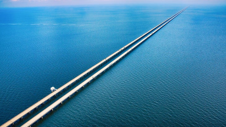
Driving on a bridge over water for a long time can be dizzying. Stretching 24 miles, the Lake Pontchartrain Causeway also presents an infamous combination of a high speed limit over 65 mph, sudden weather changes (fog, wind, and thunderstorms) without a shoulder in sight. In other words, it’s a pileup waiting to happen. More than 40 cars crashed into each other in the fog on December 17th last year, one of multiple annual weather events that led to lengthy lane closures followed by police escorts across the bridge.
“Slow down, use low-beam headlights, and avoid overdriving your visibility,” says Nelson, when asked about driving in fog and low-light conditions. “If you can’t see, neither can other drivers; space and speed are your lifelines.”
I-5, Washington
Rare is the day when the southbound, northbound, or both lanes aren’t backed up somewhere between Seattle and the Canadian border. Like many of America’s interstate highways, I-5 was not designed for the volume of traffic that travels today. The winter conditions also change significantly along this 145-mile stretch, beginning with freezing temperatures in Bellingham, snow accumulation in the Skagit Valley’s convergent zone and rain throughout the greater Seattle area, often with heavy accumulations that can cause on-road flooding. Fog-laden marine layers also muddle the mix.
Nelson says to practice these well-researched techniques when driving in wet conditions, “Lower your speed, turn up your following distance, and never use cruise control. Even a thin layer of water can send a car into a skid.”
U.S. Route 1, Florida
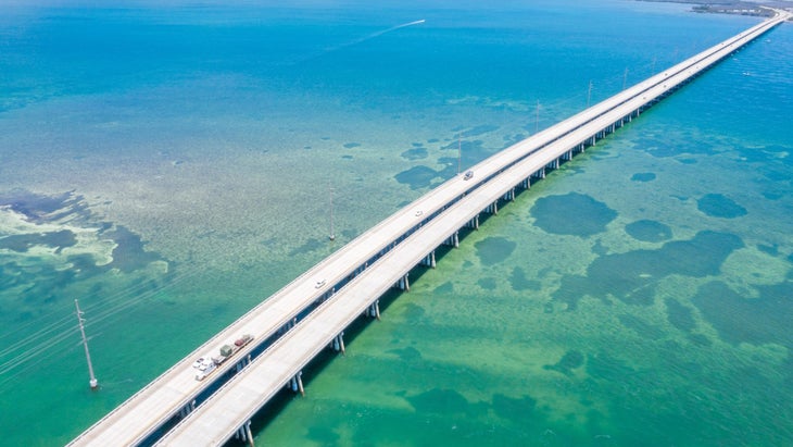
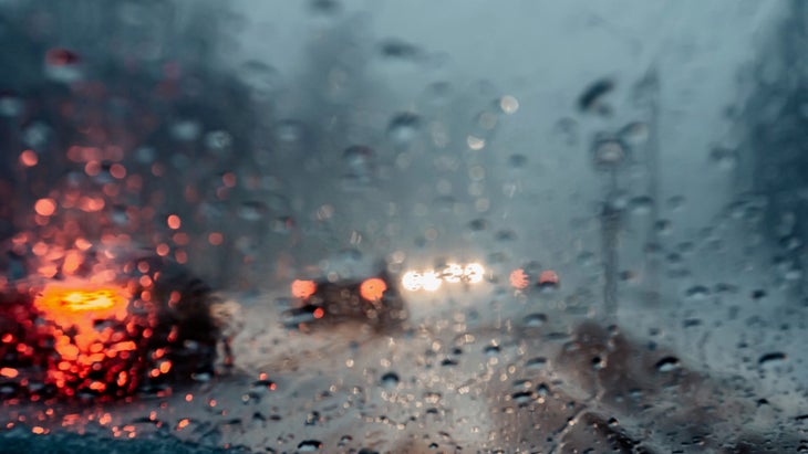
Distracted driving remains an epidemic across America. More than 3,200 traffic fatalities were linked to distracted driving in 2023 alone, according to the National Highway Traffic Safety Administration. U.S. Route 1 drivers across the East Coast are especially vulnerable, given the combination of stoplights, highway speeds and motorist volume. The 113-mile Overseas Highway, including the Seven Mile Bridge and 41 other spans, challenged drivers’ concentration long before mobile phones. Lengthy drives over the many bridges here can trigger highway hypnosis, a nap-like mental state caused by the bridge’s unique vibrations, monotonous scenery and the sense of going nowhere that leads one’s brain to shift to (non-existent) autopilot.
“The biggest underestimated threat on the road isn’t weather or road design,” says Nelson. “It’s a moment of inattention. Looking down for two seconds at 60 mph means you’ve driven blind for the length of a football field.”
I-15, Nevada-California

Physical exertion, monotony and distracted (potentially inebriated) drivers can create a potentially lethal cocktail on I-15, the primary highway connecting Las Vegas and Southern California. The 332 miles between The Strip and San Diego also featureless-advertised but no less dazzling trails through the Rock Canyon National Conservation Area, Death Valley National Park, and Mojave National Preserve hat are, like much of I-15 itself, extremely arid environments with few or no services. Whether you plan to complete a slot canyon hike or summit Telescope Peak, you’ll need to stay sharp (and hydrated!) on this road that is infamous for distracted and exhausted drivers.
“Monotony invites fatigue,” states Nelson. “Take a break every two hours, switch drivers when possible, and avoid driving when you’d normally be asleep. If you feel your eyelids getting heavy, you’re already in danger, so find a safe place to stop for a 20-30 minute nap.”
US-17, South Carolina
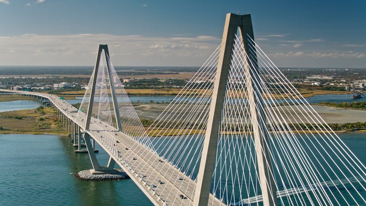
We often take a more relaxed approach when driving a rural, scenic road like US-17, yet these routes, ripe with sudden speed transitions, potential wildlife crossings, and blind corners, demand extra vigilance. Sharp turns and unanticipated curves also surprise infrequent drivers here, especially when following or, worse, being pressured from behind by local drivers who are easily frustrated by the tourist tempo. US 17 in South Carolina is referred to as the Ocean Highway or Coastal Highway, as it hugs the coast for about 200 miles, for travelers en route to Charleston and Myrtle Beach. It also contains plenty of unlit passages and, given its coastal location, sudden fog buildup or standing water after a sudden squall.
Nelson’s advice: “Rural roads may feel relaxed, but they’re where we see some of the most severe crashes. ” So expect sharp curves, hidden driveways, wildlife, and limited lighting, he says. Reduce speed and scan far ahead.
Hana Highway, Hawaii
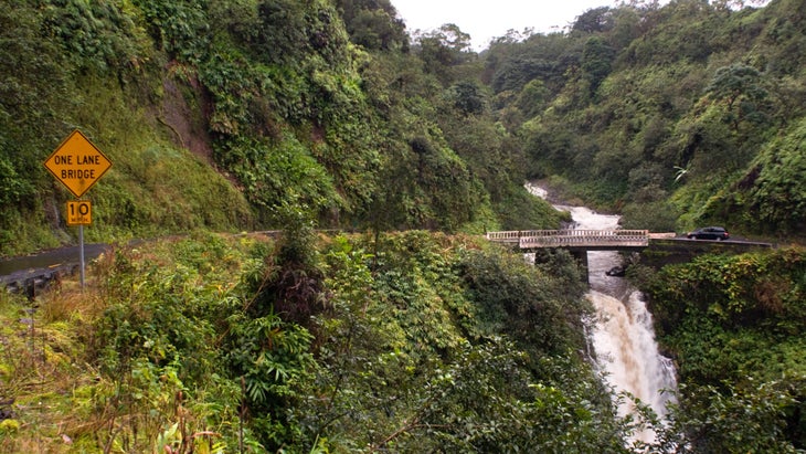
How often do we catch ourselves mesmerized by stunning paradisiacal landscapes when stationed behind the wheel? Driving practically anywhere in Hawaii presents this challenge, but especially when winding one’s way around 600+ curves, over more than 50 mostly one-lane bridges, and past gorgeous waterfalls on the Road to Hana. And don’t forget spying whale spouts from the coastal cliffs, sans guardrails! Of course, you could take Pi’ilani Highway, aka the “back road,” a more direct, less serpentine country road that is in such rough shape (narrow, gravel patches, pot holes), most car rental agencies prohibit driving on it.
“Fill up your gas tank; there are no gas stations between Pa’ia and Hana,” AAA Hawaii advises. “Also, start early and take your time.”
The post America’s Most Dangerous Roads (And How Best to Drive on Them) appeared first on Outside Online.