")


National Trails Day, celebrated on June 1, is a day to care for, and get out and explore, our nation’s trails. We’re celebrating by featuring some of the most stunning routes in the U.S. and the reasons that make them so special. Since we can’t feature every beautiful path in the country, we looked for diversity in region and terrain.
Whether you’re in the Midwest, itching for a canyon-centric adventure, or on the coast looking for a trail that leads to an isolated beach, here are 12 of the best hikes in the country.
In The West
Best Volcano Hike
Kilauea Iki Trail: Hawaii Volcanoes National Park, Hawaii
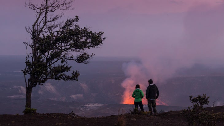
The U.S. has a shocking number of volcanoes scattered throughout the country, but Kilauea, in Hawaii Volcanoes National Park, is the most active. In fact, it’s still erupting as I write this: a small eruption started in December 2024 and is still going strong, spewing lava up to 500 feet in the air from its main vent. Don’t worry, all of this action is happening in a closed section of the park you’ll want to avoid. Instead, hike the Kilauea Iki Trail, which travels through a rainforest before dropping into a crater and crossing a lava lake formed by an eruption in 1959. Some of the lava is still warm to touch and you can find vents emanating steam throughout the lake, which occurs when rain gathers in pools and boils.
Logistics: The entrance fee to Hawaii Volcanoes is $30 per vehicle. Expect traffic delays over the next two years as the park works to remove damaged buildings and enhance the road for better vehicle flow. Check the website for updates. The USGS runs a webcam with a live view of the current eruption. If you’re in the park, you can see the activity from the Uekahuna overlook on Crater Rim Drive West and from the Kilauea Overlook.
Best Hike to a Beach
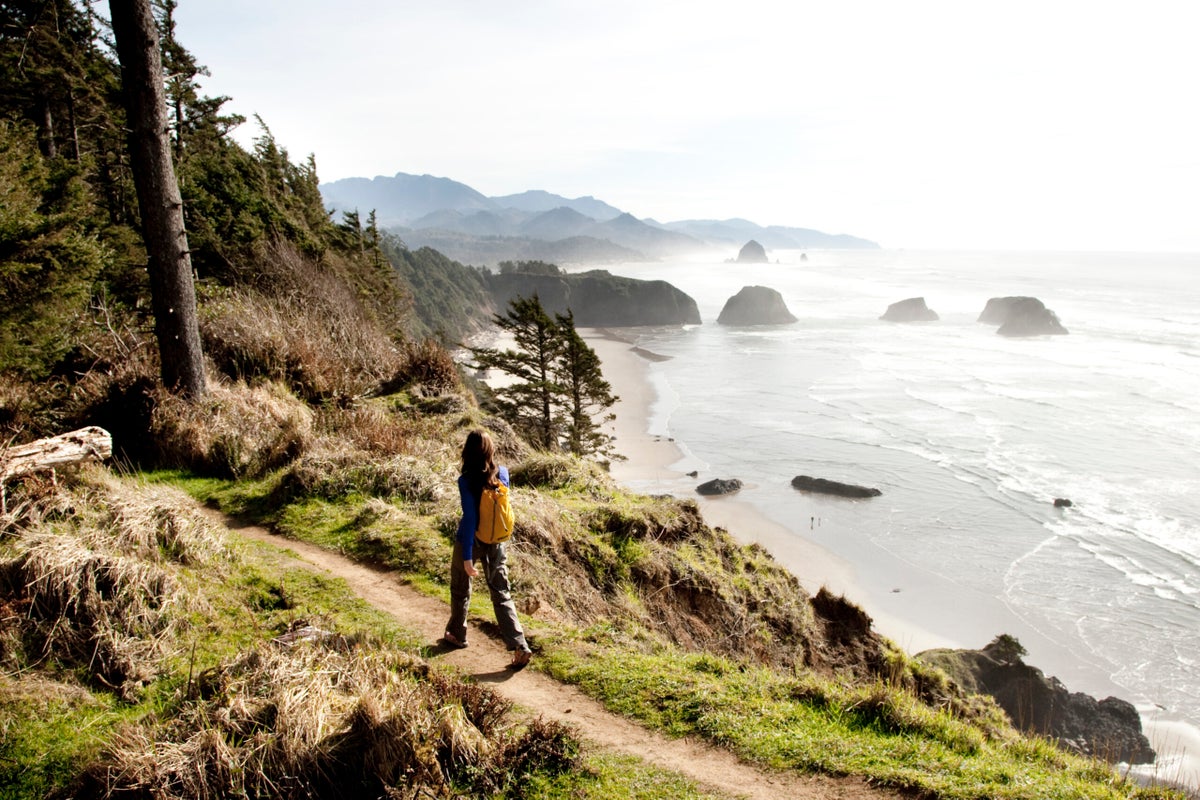
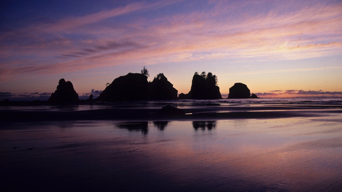
Shi Shi Beach and Point of Arches: Olympic National Park and Makah Tribal Land, Washington
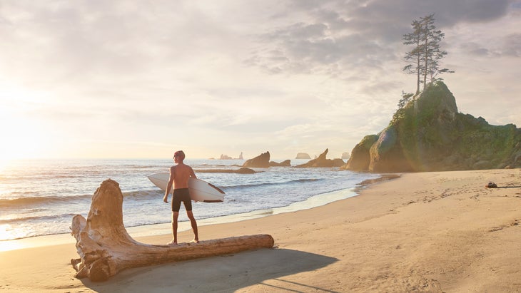
Olympic National Park boasts some dramatic coastal landscapes, and Shi Shi Beach might be the most famous thanks to its bevy of sea stacks. This eight-mile round trip hike starts in a sitka spruce forest on boardwalks before hitting switchbacks down to the beach itself. Look west and you’ll see the Pacific Ocean spreading before you and the park’s iconic sea stacks rising from the tide. The beach itself ain’t bad either, with bone-white driftwood and tide pools full of sea creatures. You’ll be tempted to stop here, but keep hiking south along the beach for 1.3 miles to hit Point of Arches, a mile-long cluster of sea stacks dotting the breaks just off the sand.
Logistics: If you’re knocking this hike in a day, you don’t need permits, but you do need the $20 Makah Recreation Pass, which you can purchase online or in person at the New Bay Marina or Museum.
Best Hike to a Technical Summit
Grand Teton: Grand Teton National Park, Wyoming
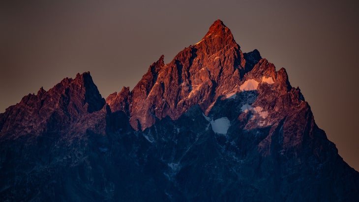
Archeological evidence suggests that the 13,776-foot, craggy Grand Teton has been luring climbers to its summit inside what is now Grand Teton National Park long before Europeans showed up. The mountain’s striking, trapezoidal shape is still the focus of hundreds of summit bids every summer. The hike and technical climb is a 14-mile roundtrip effort, gaining 7,000 feet in total elevation. If you’re going to reach the tippy top of Grand Teton, you’ll need technical climbing skills, the right gear, and preferably a guide. Some people do it in a day, but it’s better as a weekend adventure, which allows you to spend at least one night at the high elevation base camp for the final summit push. The 5.4 Owen Spalding Route is the classic, and easiest, ascent. But listen, even if you’re not interested in the technical climb, you should still do this hike, which rises from the Lupine Meadows Trailhead to the Lower Saddle for a 12-mile out and back. From the saddle, you’ll have close-range views of glaciers and long-range views of Garnet Canyon and the Alaska Basin below.
Logistics: Entrance fee to the park is $35 per vehicle. If you’re doing the full summit and plan on spending the night at one of the saddles, you’ll need a backcountry permit ($20). Book a four-day trip with Jackson Hole Mountain Guides (from $2,100 per person).
Best Slot Canyon Hike
Zebra Slot Canyon: Grand-Staircase-Escalante National Monument
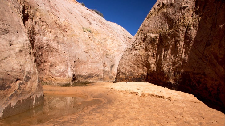
Choosing one slot canyon is a daunting task, but Zebra wins because of its gorgeous pink and tan striped walls and narrow passageways, which are as tight as 10-inches wide at some points. Also, it’s not a technical canyon to traverse, so you shouldn’t need climbing gear. You’ll still need to scramble and squeeze your way through portions of this 5.2-mile out and back hike, but make yourself skinny and you’ll be standing in the heart of a narrow gorge with pink and white striped walls rising 100 feet on either side of you. The hike starts by traversing a sandy, scrubby wash before meandering through a broad canyon with pink walls. Once you reach Zebra Canyon proper, the going gets narrow and you’ll likely find pools of water on the floor, so bring water-friendly shoes.
Logistics: There’s no entrance fee to Grand Staircase-Escalante, and you don’t need a permit to hike Zebra Canyon, but you should stop into the BLM Visitor Center to ask about the water levels within the canyon.
In The East
Best Hike to see Fall Foliage
Burrows Trail to Camel’s Hump: Vermont
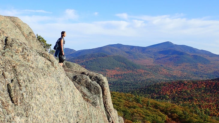
Vermont was essentially created for fall foliage, as the forest that blankets the 4,000-foot peaks throughout the state transitions into a kaleidoscope of colors starting in September. You can’t walk to get a pumpkin spice latte in the state without witnessing the show, but I say make the trek up Camel’s Hump, Vermont’s third highest peak, which offers dramatic 360-degree views that take in all of the lush canopy below as well as Lake Champlain to the west and the White Mountains of New Hampshire to the east. The 4.7-mile out and back on Burrows Trail gets you to the summit the fastest with much of the time under the colorful canopy that you’re here to marvel.
Logistics: This hike sits inside Camel’s Hump State Park, which was carved out of the Green Mountains National Forest, but there are no entrance fees or permits required. The trailhead parking area fills up fast on weekends, especially during peak foliage season, so show up early in the morning.
Best Ridgeline Hike
Rocky Peak Ridge, High Peaks Wilderness: Adirondacks, New York
You want mountaintop views and rocky exposure? Head to the High Peaks Wilderness of Adirondack Park. This 13-mile out and back on the East Trail climbs a series of smaller summits on its way to 4,420-foot Rocky Peak, gaining more than 5,000 feet all together. You’ll get long range views from the various rocky summits, making this feel like a true ridgeline jaunt, but you’ll also descend to saddles giving you a chance to take a rest at Mary Louise Pond toward the end of the adventure. A lot of people make it an overnighter, but it’s a doable day hike for go-getters. The view from Rocky Peak Ridge is true alpine glory, with boulders strewn through a high-alpine meadow covering the treeless peak. Hit it during the summer, and you’ll be able to forage your way through Blueberry Cobbles, a hillside that’s covered in wild fruit bushes near the trailhead.
Logistics: There are no permits or entry fees for day hikes in the High Peaks Wilderness, but you should definitely bring a hiking partner or, at the very least, tell someone where you’re going and when you’ll be back.
Best Trail to See a Gigantic Waterfall
Rainbow Falls Trail: Pisgah National Forest, North Carolina
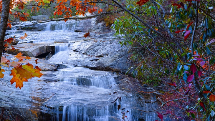
I’d argue that Rainbow Falls is one of the most impressive waterfalls in the Southern Appalachians, period. The entire Horsepasture River plummets over the side of a sheer, granite cliff, dropping 150 feet straight into a deep pool. Time it right after heavy summer storms and the volume of the waterfall is thunderous. Follow the Rainbow Falls Trail for two miles along the bustling Horsepasture River, a drop and pool creek with plenty of swimming hole potential, until you reach the base of Rainbow Falls. There’s good swimming at the base of the falls, just don’t try to climb the cliff or wade at the top of the waterfall, as visitors have died doing those very things.
Logistics: Rainbow Falls is located in Pisgah National Forest, but the trailhead is located inside Gorges State Park. There are no fees for visiting the park or falls. Bring your swimsuit and water shoes or sandals because you’re going to want to swim.
Best Hike to See Natural Arches in the East
Auxier Ridge Trail: Red River Gorge, Kentucky
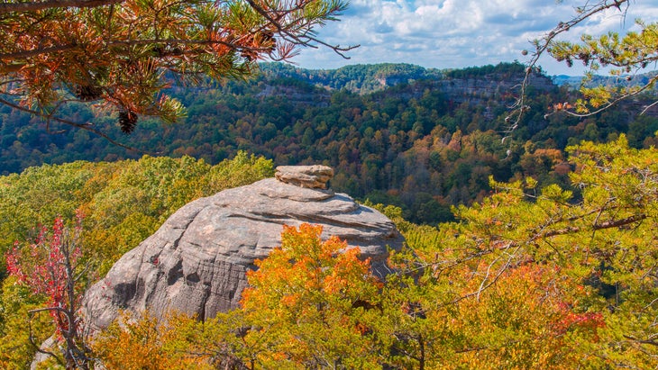
Kentucky’s Red River Gorge is a vast canyon system inside Daniel Boone National Forest that’s best known for its sport climbing, but the gorge has more than 100 natural arches, the highest concentration of such rock outcroppings east of the Rockies. This isn’t the desert landscape you might expect though, as the forest is lush and green with sandstone arches stretching out from the canopy. Most of the arches are scattered throughout the area’s 29,000 acres. Focus your attention on the 2.5-mile Auxier Ridge Trail, and you’ll see the towering Courthouse Rock, which rises from the forest like a courthouse looming over the town square. You can also take side hikes to half a dozen arches, including the aptly-named Double Arch, where a smaller arch is stacked inside a larger arch.
Logistics: Red River Gorge is relatively primitive. Some trails are marked, while un-signed social trails lead to hidden goodies like Star Gap Arch, a large natural bridge on the edge of a cliff. You don’t need permits and there are no entrance fees.
[[In The]] Midwest
Best Cliff Hike in the Midwest
Big Bluff: Buffalo National River, Arkansas
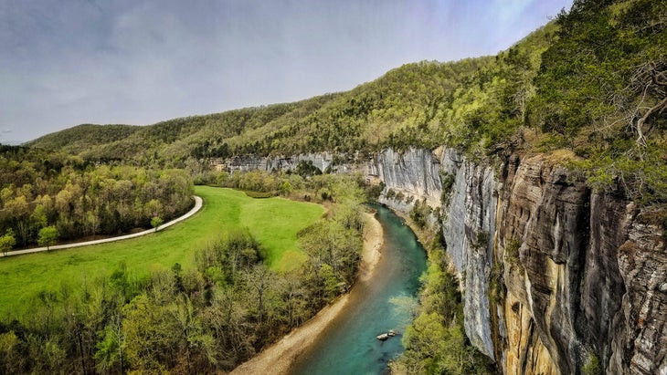
I like any trail that comes with the caveat “not recommended for children.” Not because I don’t like hiking with kids, but because this usually means there will be cliff-top exposure, and that means beautiful views. Such is the case with the Goat Trail, a half-mile-long steep climb on a narrow ledge to the edge of Big Bluff, a sandstone cliff that dominates a dramatic bend in the Buffalo River. Big Bluff lives up to its name, rising 550 feet from the valley and delivering a long range view of the sinuous waterway below. In fact, it’s the tallest sheer cliff between the Rockies and the Appalachians. Big Bluff is also known for its scrappy juniper trees, which are estimated to be 800 years old. Most of the hike is actually on the Centerpoint Trail, which follows an old wagon road as it drops 1,300 feet to the river over 2.5 miles. All in, it’s a 6-mile out and back with roughly 2,000 feet of climbing.
Logistics: There’s no entrance fee to the Buffalo National River. I’m not kidding about the exposure on this hike. It’s not for the faint of heart, so be prepared and be careful.
Best Canyon Hike
Starved Rock State Park, Illinois
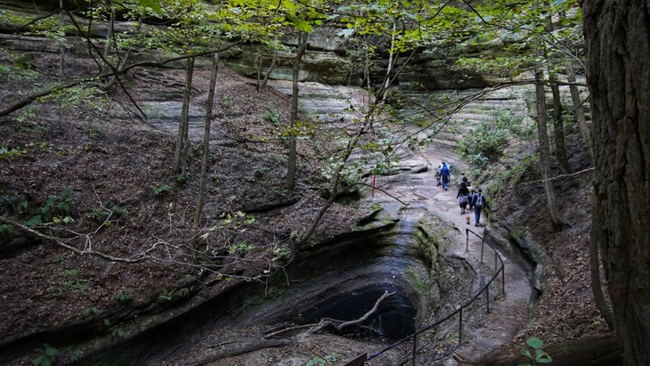
At first glance, you’d think the Illinois River would be the central attraction to Starved Rock State Park; the large body of water seems to dominate the landscape after all. But it’s the small canyons that feed the large river that hikers seem to love. More than a dozen narrow and lush gorges have been carved on the southern side of the river, giving hikers an enticing labyrinth of rock to explore via 13 miles of established trail.
If you’re moving at a fast pace, you can explore every canyon in the park in a day, but focus on French Canyon, which has a narrows section reminiscent of Utah, but with more greenery, and Wildcat Canyon, which has vertical walls and an 80 foot waterfall that runs after a rain. Take a map and spend an afternoon creating your own loop through the maze of canyons.
Logistics: Most hikes begin at the Visitor’s Center. Grab a map. There are a lot of short trails throughout the park that you’ll have to connect to create a larger hike. All state parks in Illinois are free to enter.
Best Prairie Hike
Sheyenne National Grassland, North Dakota
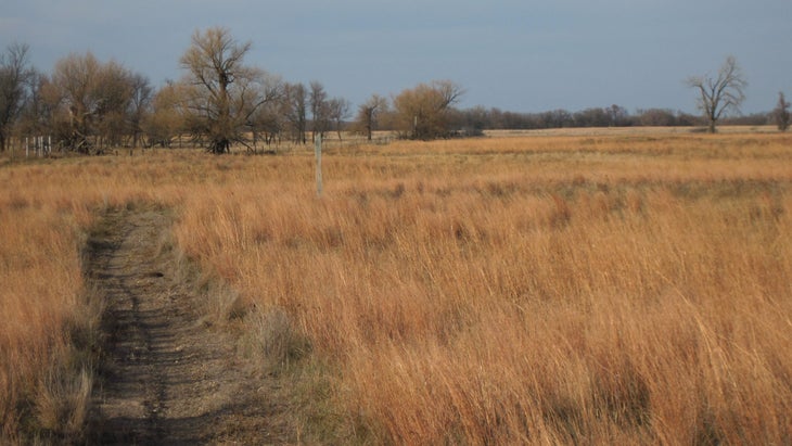
Are prairies beautiful? Hell yes. Especially if all you’ve ever known is mountains or coast. There’s something fascinating about being able to see for a hundred miles in any direction, and the Sheyenne National Grassland might be the best of our prairies, as it protects 135,000 acres of sand dunes and tall grass in southern North Dakota. The National Grassland also hosts a 30-mile section of the North Country National Scenic Trail, which runs for more than 4,000 miles from Vermont to North Dakota. The hiking is easy, but you’re not here for a challenge. You’re here for the expansive field of view that only the midwest can offer. Much of the hiking is flat with shimmering waves of grass all the way to the horizon in every direction. Head to the West Trailhead of the North Country National Scenic Trail for a 6.5-mile section that runs between two highways, passing through tall grass, wildflowers in the summer, and the occasional grove of trees.
Logistics: Show up in the middle of summer for the best weather and best wildflowers. There’s no entrance fee to the National Grassland.
Best Backcountry Lake Hike
Secret/Blackstone Loop, Boundary Waters Canoe Area
I know, the Boundary Waters are for canoeing, and you’re not wrong, but there are also hiking trails that connect many of the backcountry lakes. Granted, most of those trails are multi-day endeavors for the hardy looking to navigate the wilderness. But there’s also the four-mile Secret Blackstone Loop near Ely, which is a rarity in the Boundary Waters in that it is short, signed, and easy to follow. Bonus: It takes in four different lakes on its figure-eight journey through a pine forest. The hiking is mostly flat, and you’ll walk right to the grassy edge of Blackstone Lake if you want to take a dip, as well as scamper to rocky overlooks of Ennis Lake. In addition to walking along the banks of Secret, Blackstone, and Ennis Lakes, you’ll also find a small, unnamed pond along the way. Blackstone, the first lake you’ll reach on the hike, is arguably the highlight of the trip as it’s water is clear and ideal for swimming, or paddling if you want to lug a craft of some sort with you.
Logistics: This is a straightforward day hike, but all visitors must get a permit ($16 per adult) when entering Boundary Waters Canoe Area. You can snag them in advance or at the self-serve kiosks at entry points. The forest maintains a quota system to limit the number of people inside the Boundary Waters, so it’s smart to make a reservation in advance ($6 reservation fee).
Graham Averill is Outside magazine’s national-parks columnist. Based in Asheville, North Carolina, he is fortunate enough to live within a few hours of many world-class hikes. He recently wrote about the best hikes in Joshua Tree National Park, his favorite mountain town, and the the most adventurous national park.
The post The 12 Most Stunning Trails in the U.S. appeared first on Outside Online.